基于多源数据城市土地利用类型精细化识别与功能演替分析

刘彦随, 金淑贞, 王伟, 张诗涵, 薛岩欣

人文地理 ›› 2026, Vol. 41 ›› Issue (1) : 1-11, 33.

PDF(56526 KB)
PDF(56526 KB)
人文地理 ›› 2026, Vol. 41 ›› Issue (1) : 1-11, 33. DOI: 10.13959/j.issn.1003-2398.2026.01.001
城市

基于多源数据城市土地利用类型精细化识别与功能演替分析

作者信息 +

REFINED IDENTIFICATION AND FUNCTIONAL SUCCESSION ANALYSIS OF URBAN LAND USE TYPES BASED ON MULTI-SOURCE DATA

Author information +
文章历史 +

摘要

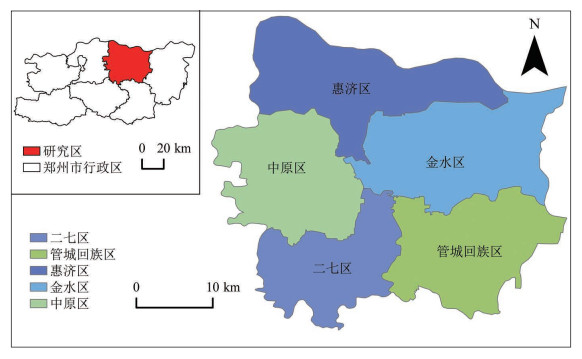
精细化识别城市土地利用类型与功能演替分析,揭示空间形态与社会功能的分布特征,为科学认知城市发展规律及优化国土空间规划管理提供理论支撑与实践指引。本研究以郑州市主城区为研究对象,整合遥感影像、POI数据和OSM路网数据,采用核密度函数、精细化识别规则对土地利用功能类型进行精准划分,结合多种空间统计方法与区位熵分析,探究2012—2022年城市各功能用地集聚扩散特征和功能演替规律。研究结果表明:①土地利用类型演变呈现显著分化与混合化特征,商业服务(简称商服)功能用地主导扩张,居住功能用地先增后减,工业与公共功能用地持续缩减,各类功能用地布局从边界清晰转向协同交错;②功能空间与建设用地扩张非同步,体现规划与经济增长的协同滞后效应;③功能重构呈差异化特征,商服集聚度最高且为多中心格局,复合功能街区呈西北—东南带状分布;④主导功能演替呈现专业化与复合化并行趋势。本研究为内陆中心城市土地精细化管控与空间优化提供科学依据。

Abstract

This study takes the central urban area of Zhengzhou City as its research object, integrating remote sensing imagery, POI data, and OSM road network data. It employs kernel density functions and precise identification rules to accurately classify land use functional types, combining various spatial statistical methods and location entropy analysis to explore the aggregation and diffusion characteristics of urban functional land use and the patterns of functional succession from 2012 to 2022. The research findings indicate: 1) The evolution of land use types exhibits significant differentiation and hybridization characteristics. 2) There is a lack of synchrony between functional spatial expansion and construction land expansion. 3) The restructuring of functional spaces exhibits differentiated patterns of aggregation and dispersion. 4) The evolution of dominant functions reflects a parallel trend toward specialization and diversification.

关键词

城市土地利用 / 精细化识别 / 功能演替 / 多源数据 / 郑州市

Key words

urban land use / refined identification / functional evolution / multi-source data / Zhengzhou city

引用本文

导出引用
刘彦随, 金淑贞, 王伟, . 基于多源数据城市土地利用类型精细化识别与功能演替分析[J]. 人文地理. 2026, 41(1): 1-11, 33 https://doi.org/10.13959/j.issn.1003-2398.2026.01.001
Yan-sui LIU, Shu-zhen JIN, Wei WANG, et al. REFINED IDENTIFICATION AND FUNCTIONAL SUCCESSION ANALYSIS OF URBAN LAND USE TYPES BASED ON MULTI-SOURCE DATA[J]. HUMAN GEOGRAPHY. 2026, 41(1): 1-11, 33 https://doi.org/10.13959/j.issn.1003-2398.2026.01.001
中图分类号: K921   

参考文献

1
焦利民, 李泽慧, 许刚, 等. 武汉市城市空间集聚要素的分布特征与模式[J]. 地理学报, 2017, 72 (8): 1432- 1443.
Jiao Limin , Li Zehui , Xu Gang , et al. The characteristics and patterns of spatially aggregated elements in urban areas of Wuhan[J]. Acta Geographica Sinica, 2017, 72 (8): 1432- 1443.
2
李岩, 林安琪, 吴浩, 等. 顾及空间尺度效应的城市土地利用变化精细化模拟[J]. 地理学报, 2022, 77 (11): 2738- 2756.
Li Yan , Lin Anqi , Wu Hao , et al. Refined simulation of urban land use change with emphasis on spatial scale effect[J]. Acta Geographica Sinica, 2022, 77 (11): 2738- 2756.
3
Cai L , Xu J , Liu J , et al. Sensing multiple semantics of urban space from crowdsourcing positioning data[J]. Cities, 2019, 93, 31- 42.
4
Gao S , Janowicz K , Couclelis H . Extracting urban functional regions from points of interest and human activities on location‐based social networks[J]. Transactions in GIS, 2017, 21 (3): 446- 467.
5
Xeu B , Xiao X , Lin J Z , et al. Multi-source data-driven identification of urban functional areas: A case of Shenyang, China[J]. Chinese Geographical Science, 2022, 33 (1): 21- 35.
6
Liu B H , Deng Y B , Li M , et al. Classification schemes and identification methods for urban functional zone: A review of recent papers[J]. Applied Sciences, 2021, 11 (21): 9968.
7
杨君, 何欢, 胡巧莲, 等. 基于路网密度的城市功能用地空间分布相关性研究——以益阳市中心城区为例[J]. 经济地理, 2018, 38 (12): 97- 103.
Yang Jun , He Huan , Hu Qiaolian , et al. Relationships between road network density and spatial distribution of urban functional land: A case study of central urban area in Yiyang city[J]. Economic Geography, 2018, 38 (12): 97- 103.
8
韦烨娜, 吴升. 融合区域嵌入表示的城市功能区识别方法[J]. 地球信息科学学报, 2025, 27 (2): 424- 440.
Wei Yena , Wu Sheng . A method for identifying urban functional regions by integrating regional embedding representations[J]. Journal of Geo-information Science, 2025, 27 (2): 424- 440.
9
吴佳楠, 储君, 孙裔煜, 等. SOFM网络下的深圳市城市用地功能识别分析[J]. 北京大学学报(自然科学版), 2022, 58 (4): 664- 672.
Wu Jianan , Chu Jun , Sun Yiyu , et al. Analysis of urban land use function identification in Shenzhen based on SOFM network[J]. Acta Scientiarum Naturalium Universitatis Pekinensis, 2022, 58 (4): 664- 672.
10
Niu H , Li L , Zhao P . Analysing the dynamics of urban functional areas in a rapidly changing spatial structure: Using points of interest data[J]. Cities, 2025, 165.
11
潘福全, 夏家琪, 宋夫才, 等. 基于出租车时序数据聚类的城市功能区识别与分析[J]. 山东科技大学学报(自然科学版), 2023, 42 (5): 117- 130.
Pan Fuquan , Xia Jiaqi , Song Fucai , et al. Identification and analysis of urban functional areas based on taxitime-series data clustering[J]. Journal of Shandong University of Science and Technology(Natural Science), 2023, 42 (5): 117- 130.
12
肖迪, 张小咏, 胡杨. 基于手机大数据的城市功能区识别方法[J]. 系统仿真学报, 2019, 31 (11): 2281- 2288.
Xiao Di , Zhang Xiaoyong , Hu Yang . Urban functional area identification method based on mobile big data[J]. Journal of System Simulation, 2019, 31 (11): 2281- 2288.
13
高原, 王洁, 李钢, 等. 城市用地功能精细化识别方法: 时序动态图嵌入深度学习模型[J]. 地球信息科学学报, 2022, 24 (10): 1968- 1981.
Gao Yuan , Wang Jie , Li Gang , et al. Time series dynamic graph embedding: A method for precision identification of urban functions[J]. Journal of Geo-information Science, 2022, 24 (10): 1968- 1981.
14
Wang S , Zhao C , Jiang Q , et al. Application of graph convolutional neural networks and multi-sources data on urban functional zones identification: A case study of Changchun, China[J]. Sustainable Cities and Society, 2025, 119.
15
Luo S H , Liu Y , Du M Y , et al. The influence of spatial grid division on the layout analysis of urban functional areas[J]. ISPRS International Journal of Geo-Information, 2021, 10 (3): 189.
16
Yao Y , Li X , Liu X , et al. Sensing spatial distribution of urban land use by integrating points-of-interest and Google Word2Vec model[J]. International Journal of Geographical Information Science, 2016, 31 (4): 825- 848.
17
赵莹, 张朝枝, 金钰涵. 基于手机数据可靠性分析的旅游城市功能空间识别研究[J]. 人文地理, 2018, 33 (3): 137- 144.
Zhao Ying , Zhang Chazhi , Jin Yuhan . How reliable are cellular positioning data in tourism environments? An exploration of functional regions[J]. Human Geography, 2018, 33 (3): 137- 144.
18
Zhang B W , Zhong C , Gao Q L , et al. Delineating urban functional zones using mobile phone data: A case study of cross-boundary inte gration in Shenzhen-Dongguan-Huizhou area[J]. Computers, Environment and Urban Systems, 2022, 98.
19
Sun R , Su X , Yuan Q , et al. Urban region function classification via fusing optical imagery and social media data: A spatio-temporal Transformer interaction approach[J]. Information Fusion, 2025, 121.
20
Hu S , Gao S , Wu L , et al. Urban function classification at road segment level using taxi trajectory data: A graph convolutional neural network approach[J]. Computers, Environment and Urban Systems, 2021, 87.
21
Wu H , Lin A Q , Xing X D , et al. Identifying core driving factors of urban land use change from global land cover products and POI data using the random forest method[J]. International Journal of Applied Earth Observation and Geoinformation, 2021, 103.
22
赵卫锋, 李清泉, 李必军. 利用城市POI数据提取分层地标[J]. 遥感学报, 2011, 15 (5): 973- 988.
Zhao Weifeng , Li Qingquan , Li Bijun , et al. Extracting hierarchical landmarks from urban POI data[J]. National Remote Sensing Bulletin, 2011, 15 (5): 973- 988.
23
谷岩岩, 焦利民, 董婷, 等. 基于多源数据的城市功能区识别及相互作用分析[J]. 武汉大学学报(信息科学版), 2018, 43 (7): 1113- 1121.
Gu Yanyan , Jiao Limin , Dong Ting , et al. Spatial distribution and interaction analysis of urban functional areas based on multi-source data[J]. Geomatics and Information Science of Wuhan University, 2018, 43 (7): 1113- 1121.
24
孙明英, 王灵芝, 钟巧莹, 等. 基于POI数据的城市功能识别与分布特征研究——以长春市区为例[J]. 西南大学学报(自然科学版), 2025, 47 (1): 189- 199.
Sun Mingying , Wang Lingzhi , Zhong Qiaoying , et al. Research on urban function identification and distribution characteristics based on POI data: Take urban area of Changchun as an example[J]. Journal of Southwest University(Natural Science Edition), 2025, 47 (1): 189- 199.
25
刘子菲, 郭鹏, 孙艳玲, 等. 基于POI数据的城市功能区识别及其空间分布特征——以珠海市中心城区为例[J]. 天津师范大学学报(自然科学版), 2024, 44 (4): 46- 52.
Liu Zifei , Guo Peng , Sun Yanling , et al. Identification and spatial distribution characteristics of urban functional areas based on multi-source data: A case study of the central urban area of Zhuhai[J]. Journal of Tianjin Normal University(Natural Science Edition), 2024, 44 (4): 46- 52.
26
张雪洁, 王成新, 王博洋, 等. 交通路网中心性对土地利用强度的影响研究——以青岛市中心城区为例[J]. 人文地理, 2022, 37 (6): 161- 170.
Zhang Xeujie , Wang Chengxin , Wang Boyang , et al. Study on the influence of traffic network centralityon land use intensity: A case study of Qingdao[J]. Human Geography, 2022, 37 (6): 161- 170.
27
孙毅中, 杨静, 宋书颖, 等. 多层次矢量元胞自动机建模及土地利用变化模拟[J]. 地理学报, 2020, 75 (10): 2164- 2179.
Sun Yizhong , Yang Jing , Song Shuying , et al. Modeling of multilevel vector cellular automata and its simulation of landuse changet[J]. Acta Geographica Sinica, 2020, 75 (10): 2164- 2179.
28
Johnson B A , Iizuka K . Integrating OpenStreetMap crowdsourced data and Landsat time-series imagery for rapid land use/land cover (LULC) mapping: Case study of the Laguna de Bay area of the Philippines[J]. Applied Geography, 2016, 67, 140- 149.
29
Lin A Q , Sun X M , Wu H , et al. Identifying urban building function by integrating remote sensing imagery and POI data[J]. IEEE Journal of Selected Topics in Applied Earth Observations and Remote Sensing, 2021, 14, 8864- 8875.
30
张鹏, 胡守庚, 杨剩富, 等. 基于多源数据和集成学习的城市住宅地价分布模拟——以武汉市为例[J]. 地理科学进展, 2021, 40 (10): 1664- 1677.
Zhang Peng , Hu Shougeng , Yang Shengfu , et al. Modeling urban residential land price distribution using multi-source data and ensemble learning: A case of Wuhan city[J]. Progress in Geography, 2021, 40 (10): 1664- 1677.
31
陈才, 仇阿根, 赵习枝, 等. 兴趣面数据和随机森林方法的城市功能区划分[J]. 测绘科学, 2022, 47 (7): 160-168, 226.
Chen Cai , Qiu Agen , Zhao Xizhi , et al. Urban functional area division based on AOI data and random forest method[J]. Science of Surveying and Mapping, 2022, 47 (7): 160-168, 226.
32
吴浩, 江志猛, 林安琪, 等. 基于隐性—韧性—显性的武汉城市资源环境承载力空间特征[J]. 地理学报, 2021, 76 (10): 2439- 2457.
Wu Hao , Jiang Zhimeng , Lin Anqi , et al. Analyzing spatial characteristics of urban resource and environment carrying capacity based on covert-resilient-overt: A case study of Wuhan city[J]. Acta Geographica Sinica, 2021, 76 (10): 2439- 2457.
33
Zong L , He S , Lian J , et al. Detailed mapping of urban land use based on multi-source data: A case study of Lanzhou[J]. Remote Sensing, 2020, 12 (12): 1987.
34
Zhang Y , Li Q , Huang H , et al. The combined use of remote sensing and social sensing data in fine-grained urban land use mapping: A case study in Beijing, China[J]. Remote Sensing, 2017, 9 (9): 865.
35
张景奇, 史文宝, 修春亮. POI数据在中国城市研究中的应用[J]. 地理科学, 2021, 41 (1): 140- 148.
Zhang Jingqi , Shi Wenbao , Xiu Chunliang . Urban research using points of interest data in China[J]. Geographical Science, 2021, 41 (1): 140- 148.
36
薛冰, 赵冰玉, 肖骁, 等. 基于POI大数据的资源型城市功能区识别方法与实证——以辽宁省本溪市为例[J]. 人文地理, 2020, 35 (4): 81- 90.
Xue Bing , Zhao Bingyu , Xiao Xiao , et al. A POI data-based study on urban functional areas of there sources based city: A case study of Benxi, Liaoning[J]. Human Geography, 2020, 35 (4): 81- 90.
37
王海军, 夏畅, 张安琪, 等. 基于空间句法的扩张强度指数及其在城镇扩展分析中的应用[J]. 地理学报, 2016, 71 (8): 1302- 1314.
Wang Haijun , Xia Chang , Zhang Anqi , et al. Space syntax expand intensity index and its applications to quantitative analysis of urban expansion[J]. Acta Geographica Sinica, 2016, 71 (8): 1302- 1314.
38
廖嘉妍, 张景秋. 基于POI数据的北京城市文化设施空间分布特征研究[J]. 北京联合大学学报, 2020, 34 (1): 23- 33.
Liao Jiayan , Zhang Jingqiu . Research on distribution characteristics of cultural facilities in Beijing based on POI data[J]. Journal of Beijing Union University, 2020, 34 (1): 23- 33.
39
湛东升, 张文忠, 党云晓, 等. 北京市公共服务设施空间集聚特征分析[J]. 经济地理, 2018, 38 (12): 76- 82.
Zhan Dongsheng , Zhang Wenzhong , Dang Yunxiao , et al. Spatial clustering analysis of public service facilities in Beijing[J]. Economic Geography, 2018, 38 (12): 76- 82.
40
胡苗苗, 闫庆武, 李建辉. 基于DMSP/OLS和NPP/VⅡRS夜光影像的中原城市群城市扩张的时空演变及驱动力分析[J]. 自然资源遥感, 2024, 36 (1): 189- 199.
Hu Miaomiao , Yan Qingwu , Li Jianhui . Analyzing the spatio-temporal evolution of urban expansion in the Central Plains urban agglomeration and its driving force based on DMSP/OLS and NPP/VⅡRS nighttime light images[J]. Remote Sensing for Natural Resources, 2024, 36 (1): 189- 199.
41
张慧馨, 张丽君, 秦耀辰, 等. 基于POI大数据的开封市城市功能扩张与演替特征分析[J]. 地球信息科学学报, 2023, 25 (3): 560- 572.
Zhang Huixin , Zhang Lijun , Qin Yaochen , et al. Spatial expansion and succession characteristics of urban function in Kaifeng city based on POI big data[J]. Journal of Geo-information Science, 2023, 25 (3): 560- 572.
42
南昌. 总编《中国城乡建设统计年鉴—2022》编委会和编辑工作人员[G]. 北京: 中国统计出版社, 2022: 4-5.
Nan Chang. 《China Urban-Rural Construction Statistical Yearbook—2022》Editorial Board and Editorial Staff[G]. Beijing: China Statistics Press, 2022: 4-5.
43
李汝资, 黄晓玲, 刘耀彬. 2010—2020年中国城镇化的时空分异及影响因素[J]. 地理学报, 2023, 78 (4): 777- 791.
Li Ruzi , Huang Xiaoling , Liu Yaobin . Spatio-temporal differentiation and influencing factors of China's urbanization from 2010 to 2020[J]. Acta Geographica Sinica, 2023, 78 (4): 777- 791.
44
曲艺, 龙花楼, 曹林森. 城镇化背景下土地利用转型的环境与经济效应耦合研究框架构建[J]. 地理科学进展, 2024, 43 (4): 799- 809.
Qu Yi , Long Hualou , Cao Linsen . Construction of a research framework for coupling environmental and economic effects of land use transition under urbanization[J]. Progress in Geography, 2024, 43 (4): 799- 809.
45
关于, 阳建强. 城市中心区功能要素的构成、关联与分布——基于资本循环的演替分析[J]. 城市规划, 2019, 43 (4): 15- 23.
Guan Yu , Yang Jianqiang . Composition, relevance, and distribution of functional elements in city center: Based on the evolutional analysis of capital circulation[J]. City Planning Review, 2019, 43 (4): 15- 23.
46
湛东升, 张文忠, 张娟锋, 等. 北京市公共服务设施集聚中心识别分析[J]. 地理研究, 2020, 39 (3): 554- 569.
Zhan Dongsheng , ZhangG Wenzhong , Zhang Juanfeng , et al. Identifying urban public service facilities centers in Beijing[J]. Geographical Research, 2020, 39 (3): 554- 569.

基金

国家自然科学基金项目(42201226,42530712);河南省高校科技创新人才支持计划(24HASTIT049)

版权

版权所有,未经授权。
PDF(56526 KB)

Accesses

Citation

Detail

段落导航
相关文章

/